
UAVSAR/NASA502 had successfully completed four flights in Gabon on February 25, 27, 28 and March 1 respectively. So far we have acquired excellent data over every site we have planned, including the German Space Agency (DLR) Cal/Val sites in Mondah and Rabi, Lope National Park, the Ogooue River Basin and mangroves for both hydrology and terrestrial ecology study, and the Pongara hydrology study site near Libreville. Here is a NASA press release of our deployment to measure forests to Gabon:
http://www.jpl.nasa.gov/news/news.php?feature=5579
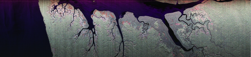
Quick look image of the mangroves in Pongara National Park flown on February 28 (sortie 2) where we acquired 5 flight lines at slightly different altitudes for TomoSAR study. This uncalibrated image was generated by UAVSAR team in Libreville on a laptop computer and it covers ~20 km cross track and ~120 km along track. The polarimetric composite is made up of HH (red), HV (green), and VV (blue) polarization channels. As expected, there are lots of forest inundation in the mangroves, which show up as reddish pink color in the polarimetric composite image.