UAVSAR aboard the NASA502 has successfully completed the Gabon deployment and returned to Palmdale, CA on Sunday, March 13. In all, we conducted 8 science flights in Gabon for terrestrial ecology study in coordination with Goddard’s LVIS lidar instrument and the European Space Agency’s two airborne radars from Germany and France respectively to support future NASA space missions (NISAR and GEDI). We also managed to acquire some opportunistic data for wetland delineation over Ogooue River for the NISAR mission science team.
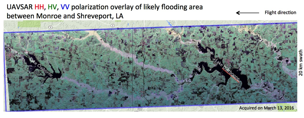
On our transit home through New Orleans, LA, we were requested by NASA HQ to participate in the Gulf Coast flooding emergency response efforts organized by FEMA. We acquired data around New Orleans as planned (land subsidence study, PI: Cathleen Jones) as well as three flight lines over the likely flooding areas near Monroe and Shreveport, LA and Longview, TX on Sunday afternoon, March 13. The data were brought back to JPL for immediate processing. By Monday morning (within 12 hours of landing) we already released polarimetric data of the three flight lines covering the likely flooding areas. Bruce Chapman then classified the images using polarimetric decomposition technique to identify the inundated vegetation and open water. These products have been sent to our colleagues at FEMA to assist NGA in their damage assessment efforts for the purpose of recovery assistance. Here’s an example of the UAVSAR imagery together with the inundation classification map.


