Airborne Glacier and Land Ice Surface Topography Interferometer
- The upgraded airborne Glacier and Ice Surface Topography Interferometer (GLISTIN-A) flew initial (8/6/12 and 8/13/12) and final (1/17/13 and 2/26/13) checkout flights on a DFRC G-III (C-20).
- Initial assessments of the Ka-band single pass interferometer (which is an interface to UAVSAR) show system performance consistent with prediction
- Instrument integration and flight process improvements have been implemented - Glacier and Ice Surface Topography Interferometer (GLISTIN) will provide all-weather, high-resolution swath ice surface topography, not available through existing lidar (i.e. ICESAT-2) or radar (CryoSAT) sensors
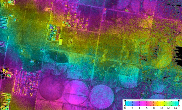 | 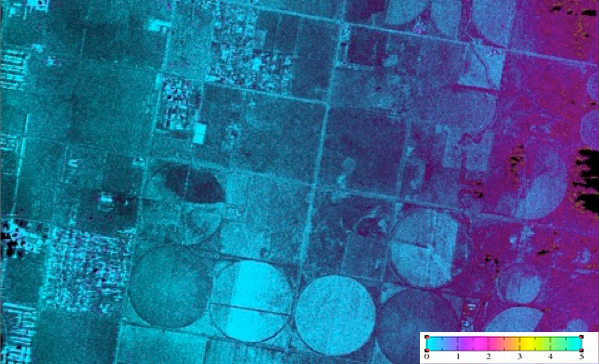 |
Example height map (Fig 1. Left) and height precision (Fig 2. Right) for a region near Palmdale. Data is 3m posting and is NOT calibrated (in progress). | |
First demonstration of mm-wave SAR interferometry (2009)
GLISTIN-A (airborne) engineering upgrades completed 2012 to improve height accuracy –results shown at right
(Fig 3) Results from GLISTIN-A engineering flight (ping-pong acquisition mode) for Rosamond area collected 8/6/12. The color represents height and one color cycle corresponds to 100m). Results posted at 10m.
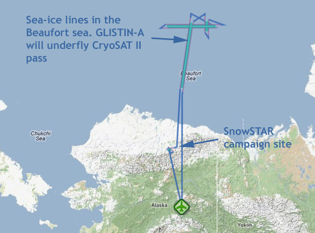
Campaign Objectives for April 2013:
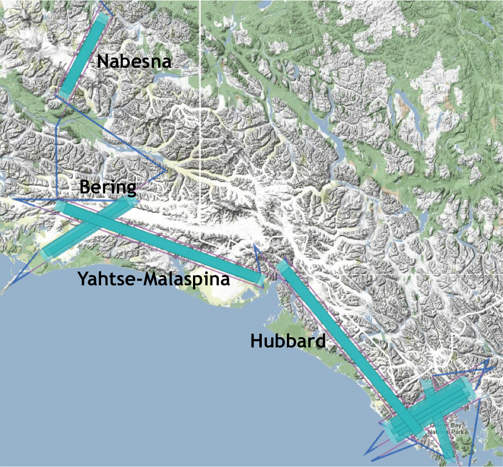
- Map glacial zones to demonstrate improved altimetric wide-swath mapping capability in the cryospheric environment;
- Mapping tidal glaciers to support science rationale in upcoming NASA science suborbital proposal;
- First experimental mapping of sea-ice demonstrating free-board measurement viability (relevant for SWOT);
- Underfly CryoSAT II for satellite cal/val, and to quantify differential penetration; and
- Collect snow-cover DEM’s at the SnowSTAR and ASO Tuolumne campaign sites for snow inventory assessment.
(Fig 5) Race tracks collected on the transit in (4/24) and the transit out (4/27) |
(Fig 6) Race tracks collected on the transit in (4/24) and the transit out (4/27) |
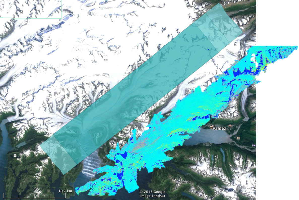
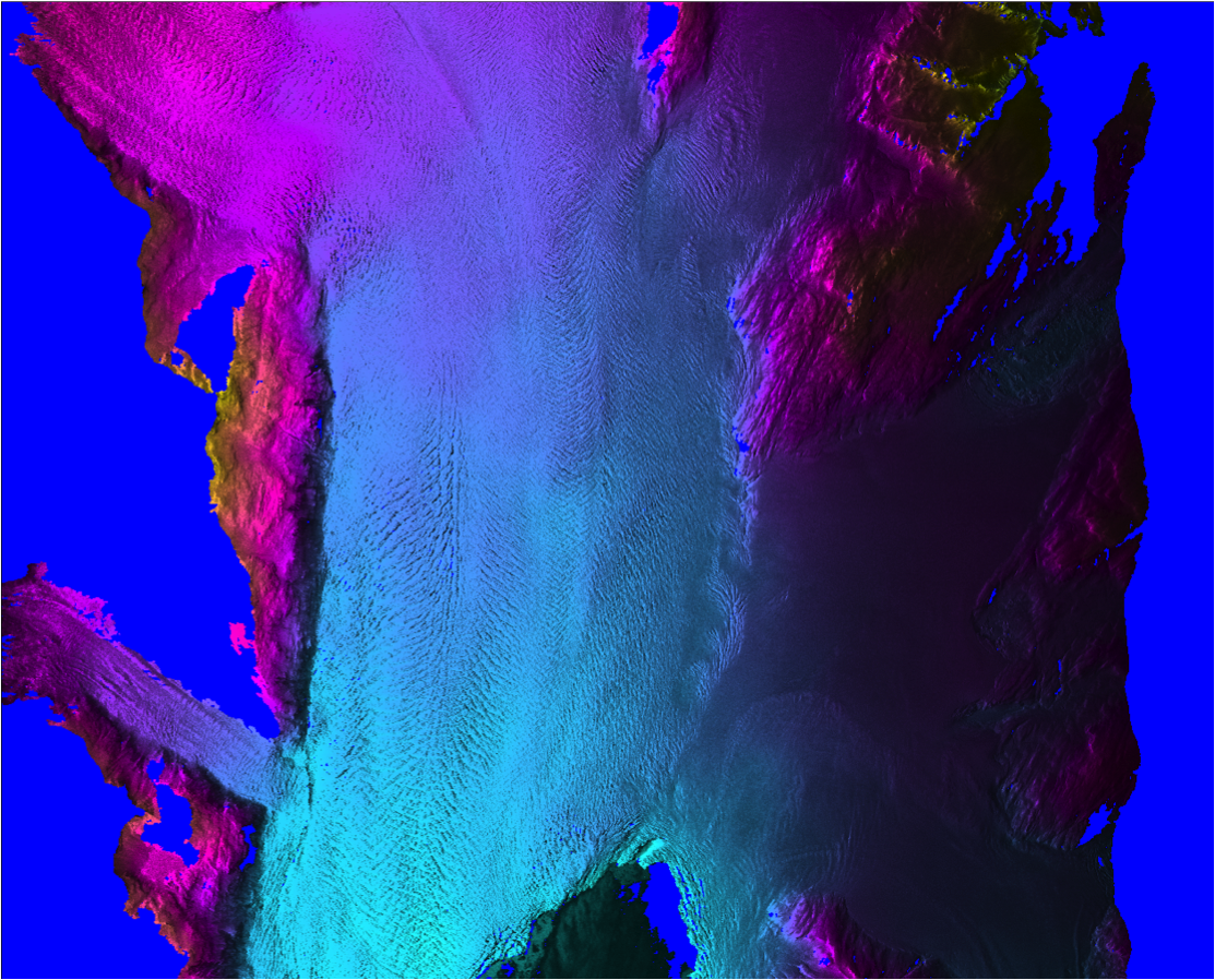
(Fig 7) Columbia Glacier |
(Fig 8) Columbia Glacier |
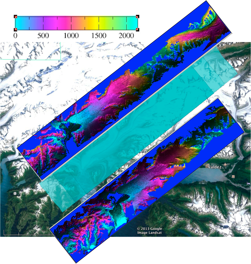
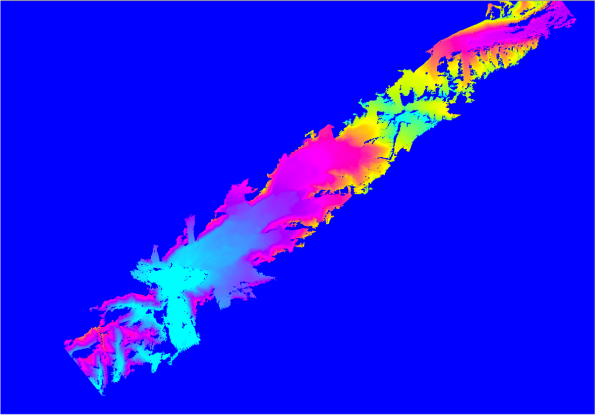
(Fig 9) Columbia Glacier Mosaic 4/24 |
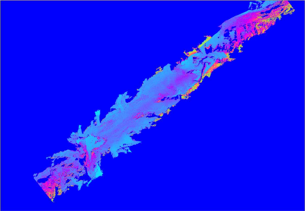
(Fig 9) Columbia Glacier Mosaic Error 4/24 |
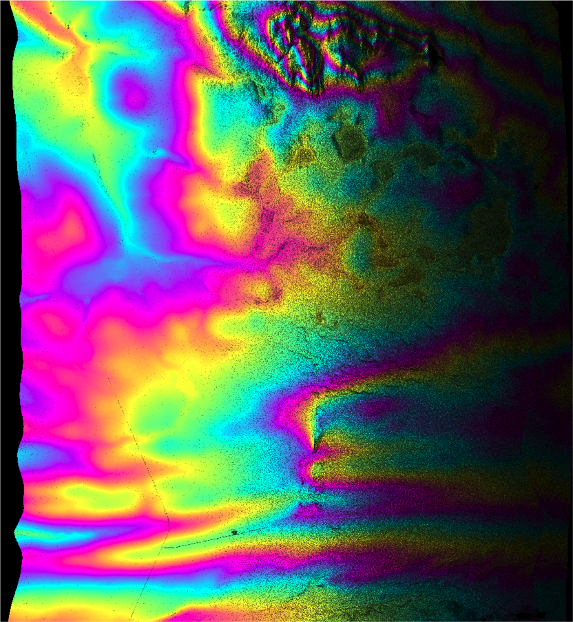
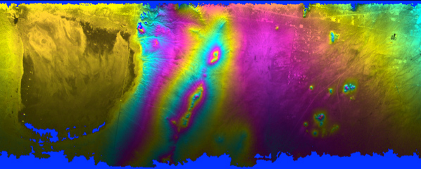
Snow hydrology basin (SNOW-STAR)
- Image is over the Toolik region for a snow hydrology experiment in Northern Alaska
- 3m posting, 12km swath
- Height errors ~10cm near-range to 2m far range - Coordinated ground and flight activities (lidar, Ku-band polarimeter, in situ ) in collaboration with CSA, ESA and NASA.
- DEM collected 4/25 a week after campaign concluded
- Conditions static in interim so meaningful intercomparison is probable - Similar collections conducted coincident with Airborne Snow Observatory (ASO – PI Painter) site in Tuolumne meadows last August (snow-off) and April (snow-on)
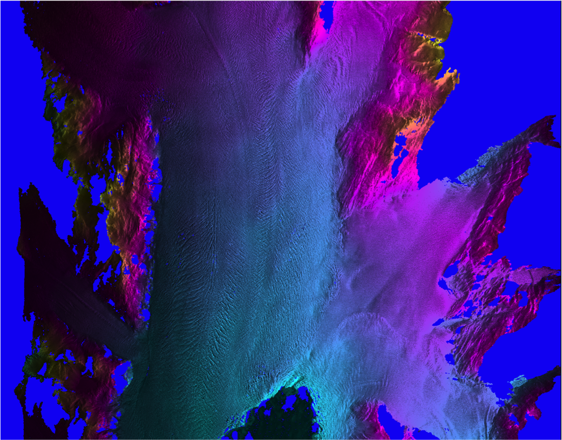
(Fig 10) GLISTIN-A Glacier Mapping 4/25/13 |