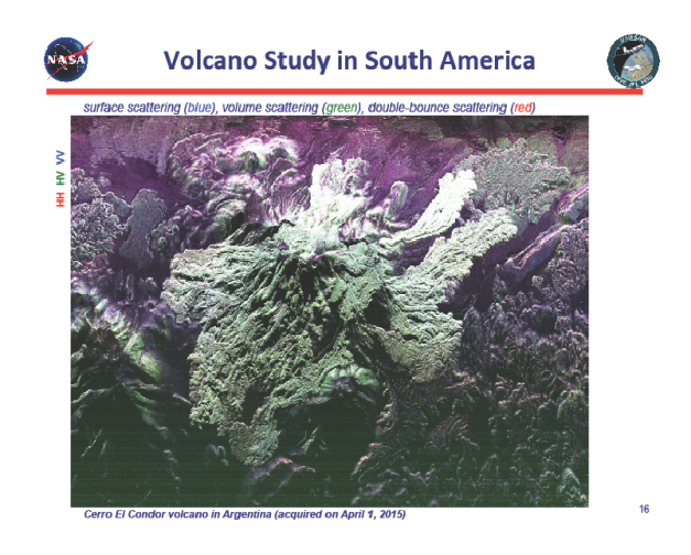
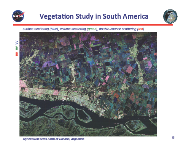
We successfully completed the month long Central/South America deployment on Sunday, April 12. In all, we flew 92 hours over 20 flights and acquired over 160 planned science data takes. After we escaped the aftermath of the 50-year flood in Chile’s Atacama Desert region, we had much better luck in Santiago, Chile and Buenos Aires, Argentina. We acquired data over the Andean volcanoes along the Chilean/Argentinian border, wetlands, agricultural areas, and calibration site selected by our colleagues at the Argentinian Space Agency, CONAE. We held a very successful open house in Buenos Aires on Monday, April 6 that was hosted by the secretary general of CONAE. We gave presentations and aircraft tour to high school students in the morning (including a GLOBE school) and to CONAE engineers/scientists as well as university researchers in the afternoon. Attached are quick-look polarimetric images from Argentina’s agricultural fields near Rosario and Cerro El Condor volcano.
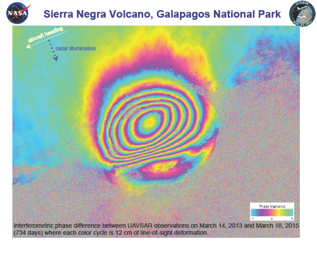
Back home we have already generated polarimetric and browse InSAR products of data acquired during the first 10 days of the deployment. One of the most striking images is an interferogram of Sierra Negra in the Galapagos where meter level deformation was observed over a two-year period (see attached image). This volcano has been very active lately and scientists at JPL and University of Miami are studying the UAVSAR data together with their colleagues in Ecuador.