You are here

UAVSAR

UAVSAR – Uninhabited Aerial Vehicle Synthetic Aperture Radar

The L-band radar aboard the AFRC C-20A aircraft is on the ABoVE deployment in Fairbanks, AK to survey permafrost and boreal forest sites in Northern Canada and Alaska.  So far we have flown 7 of the 8 planned science flights over sites in Northwest Territories of Canada and throughout Alaska including Bonanza Creek, Denali, Katmai, and Lake Clark National Parks, Yukon Delta, Seward Peninsula, and Delta Junction.  On Wednesday, we will be imaging permafrost sites in North Slope, AK.

UAVSAR – Uninhabited Aerial Vehicle Synthetic Aperture Radar

The L-band radar aboard the Armstrong C-20A aircraft has completed 3 flights during the SnowEx ground campaign period in February.  The last flight on Saturday, February 25 was flown jointly with GLISTIN-A Ka-band radar aboard the JSC G-III aircraft.  Last week we also acquired data over the Sacramento Delta for delta levee monitoring and Santa Rosa as well as central San Andreas Fault area for earthquake fault monitoring.  

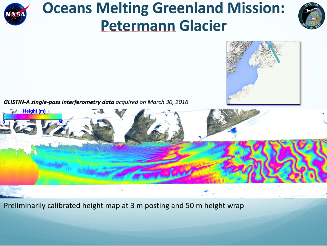
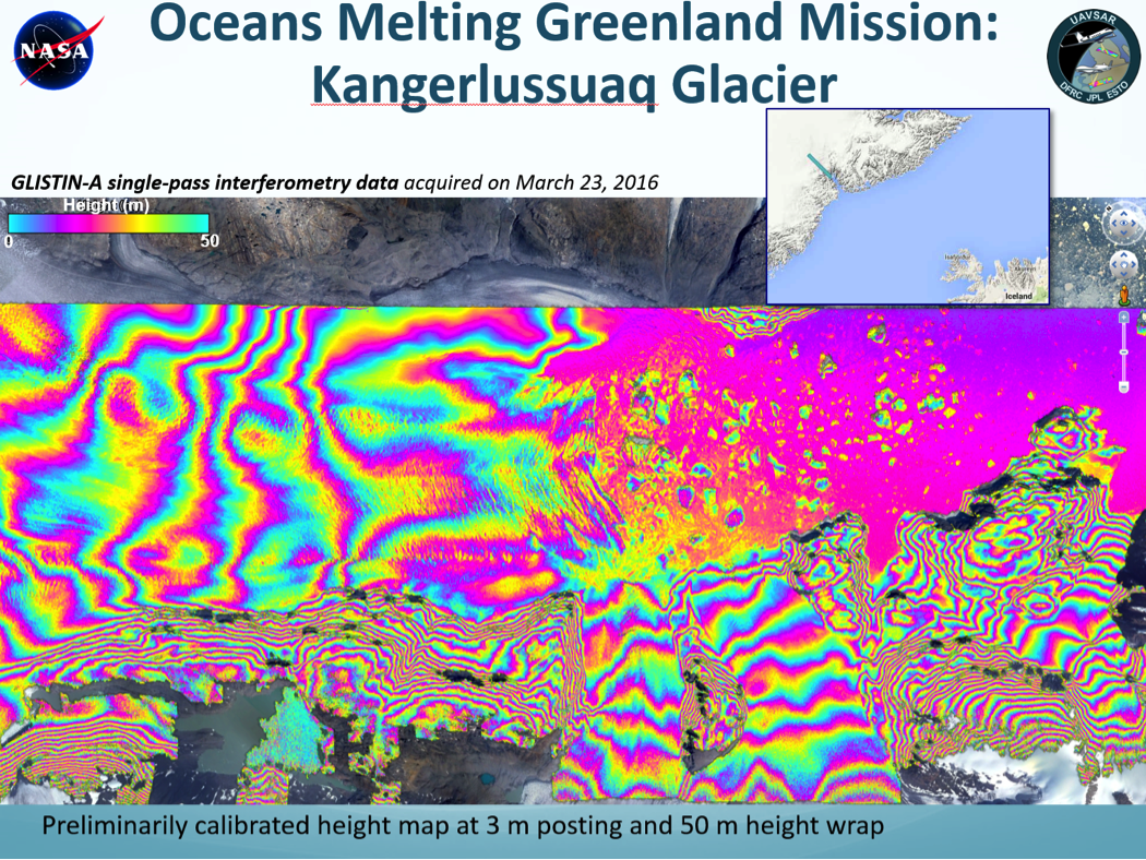
UAVSAR – Uninhabited Aerial Vehicle Synthetic Aperture Radar / GLISTEN-A - Glacier and Ice Surface Topography Interferometer

The GLISTIN-A Ka-band radar completed a successful mission to the Big Island of Hawaii to study topography change of Kilauea volcano on Thursday, February 16. The mission consisted of 3 flights on February 11, 12, and 15 to produce a base map of most of the island, and to obtain repeat observations in the areas of active lava flows from the east rift zone of Kilauea volcano.

UAVSAR – Uninhabited Aerial Vehicle Synthetic Aperture Radar / GLISTEN-A - Glacier and Ice Surface Topography Interferometer

The L-band radar completed its first two flights of the new year aboard the JSC G-III aircraft.  Imaging of the Sacramento Delta levee area was performed on the first flight and the SnowEx study sites in Colorado on the second flight.  SnowEx is a multi-year airborne snow campaign designed to collect multi-sensor aircraft data and ground truth measurements to enable algorithm development and inform the design of a future satellite mission.

UAVSAR

The L-band radar aboard the Armstrong G-III/C-20A is back in service since March 23.  We’ve been acquiring data in California, including the monthly Sacramento Delta levee monitoring, semi-annual San Andreas Fault monitoring, Baja California fault monitory, and landslide study in Slumgullion, Colorado.  Besides additional local flights for crustal deformation studies, this week we will be conducting three flights over Tuolumne River Basin to study snow accumulation with repeat-pass L-band interferometry.  

Pages

Subscribe to RSS - UAVSAR