
Wednesday, March 1, 2023
Delta-X delivered its first Level 4 product, Map of bathymetry/elevation data, on Feb 27, 2023. Figure 1 shows the merged elevation map while figure 2 shows the primary data source for each pixel. The elevation data was merged from 8 sources listed below.
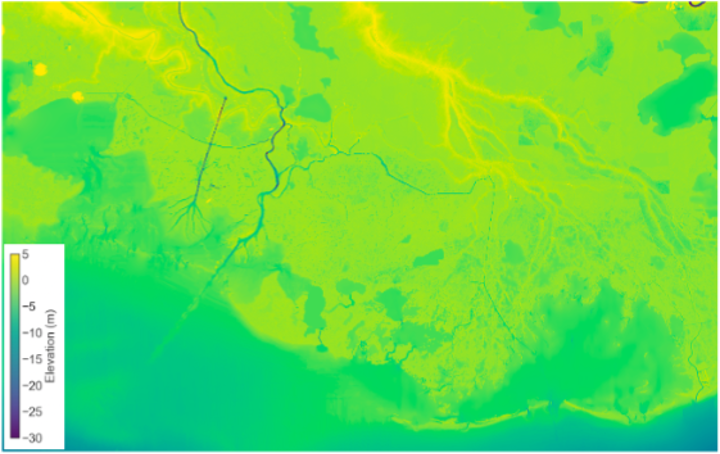
Figure 1. Delta-X merged elevation map
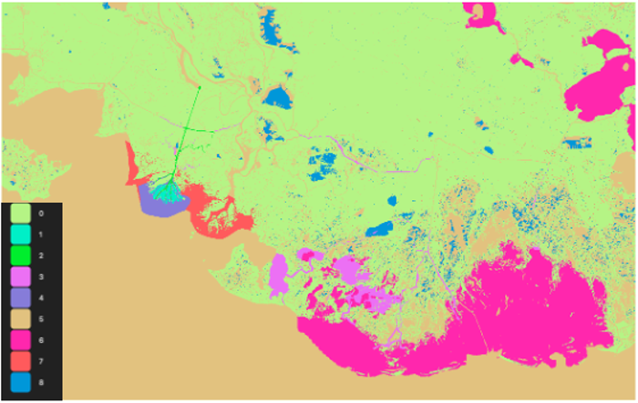
Figure 2. Primary data source for each pixel in the merged elevation map
0: Topography from USGS
1: Topography from NCALM
2: Bathymetry from Pre-Delta-X Sonar
3: Bathymetry from Delta-X Sonar
4: Bathymetry from Shaw
5: Bathymetry from NOAA2011/CoNED
6: Bathymetry from CPRA
7: Bathymetry from ADH
8: Synthetic Bathymetry (carved to -2 m in waterbodies larger than 1 Ha where no other bathymetry data was available)