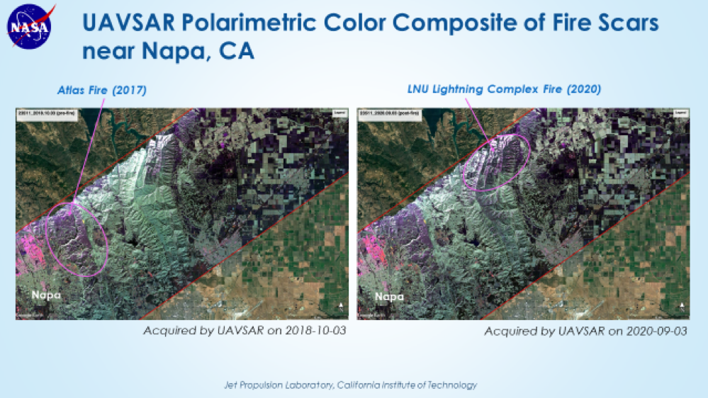
The L-band radar aboard the AFRC C-20A jet successfully completed the first California wildfire response flight on Thursday, September 3. We imaged the area north of San Francisco where the LNU Lightning Complex Fire is burning, as well as Oroville Dam site (spillway failure in 2017) and the Camp Fire scar (major fire in 2018, burned the town of Paradise, CA) and Atlas Fire scar (major fire in 2017, burned through Napa and Sonoma Counties). We had a perfect flight, with no repeat flight lines. Friday’s California wildfire response flight was scrubbed due to an aircraft maintenance issue (fuel gauge indicator). This plan will be flown tomorrow (Wednesday, September 9), where we will image fires North of Santa Cruz and the Carmel Fire and River Fire south of Monterey.
Thursday’s data were processed according to the rapid response workflow, where we generated PolSAR products in 24 hours and InSAR products in 48 hours after receipt of raw radar data. The attached viewgraph shows the LNU and Atlas fire scars in the PolSAR images. The InSAR products are being analyzed by the ARIA team (led by Sang-Ho Yun) to generate Damage Proxy Maps for the National Guard.