
Last week the L-band Synthetic Aperture Radar aboard the NASA 502 aircraft was tasked to support Hurricane Harvey flood response in southeast Texas. It arrived in Austin on Wednesday, 30 August and four daily flights were conducted over the major flood zones in the greater Houston area as well as east Texas along the Neches River through Beaumont and Port Arthur and the Sabine River.
Quick-look processing was performed on the aircraft as well as in the hotel post-landing in order to shorten the data delivery latency to the State of Texas emergency response agencies led by flood response experts from University of Texas Center for Space Research. All the quick look products were delivered within 3 hours after each radar flight and UAVSAR data are used to identify levee breach and levee over tops (water flowing over the levees) around small towns and neighborhoods, flooding in refineries, especially containment breach and over tops around the oil tank batteries. UAVSAR data are also used to identify where the “dry spot” is for disaster relief folks to stage relief centers near Beaumont.
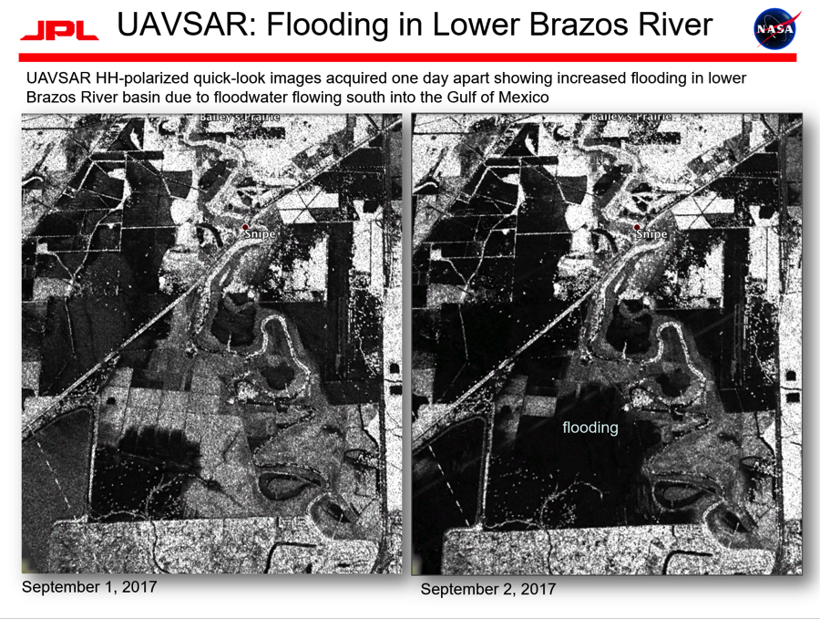
UAVSAR images acquired one day apart showing increased flooding in the
lower Brazos River basin due to floodwater flowing south into the Gulf of Mexico.