Tuesday, September 29, 2020
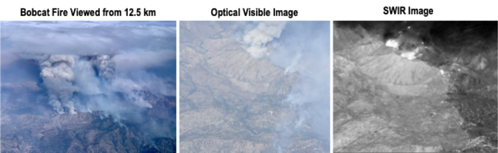
The SAR-Fusion QUAKES-I side imaging SWIR camera was flown over the northern California LNU Complex, River CZU, and Bobcat fires with the UAVSAR flights on September 3, 9, and 18, 2020 respectively. Optical images were collected out the left window with a full frame camera. The 12.5 km altitude flown for UAVSR and side imaging are useful for situational awareness above the firefighting aircraft. Visible images show the smoke plume while short wavelength infrared (SWIR) imagery sees through the smoke and shows the fire hotspots. An optical science window was installed for the Bobcat fire flight and optical images taken through the plexiglass and optical windows show the improved quality for the optical window.