On May 15, the P-band radar aboard the JSC G-III aircraft embarked on the first of the two ABoVE deployments this year in support of the Arctic-Boreal Vulnerability Experiment (ABoVE) to monitor permafrost active layer thickness, soil moisture, wetland inundation, burned area extent, and forest biomass. Eight science flights were planned for this deployment, covering study sites in Northwest Territories of Canada and throughout Alaska.
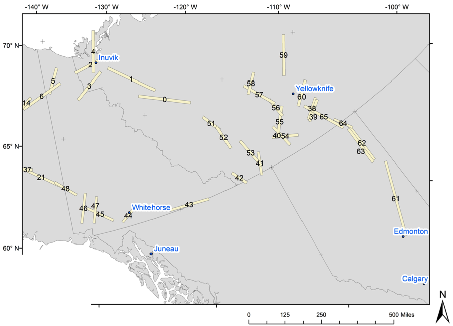
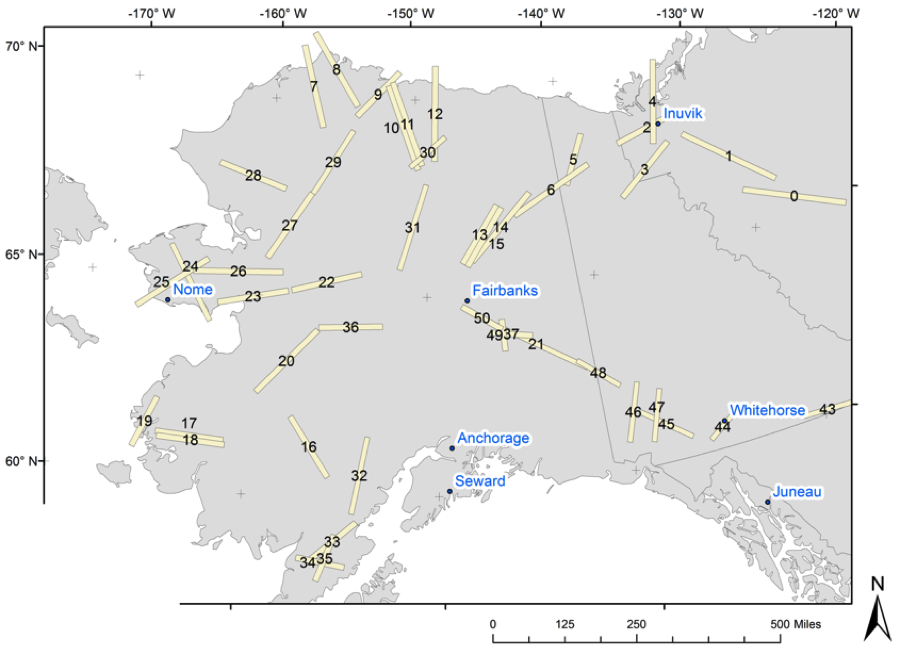
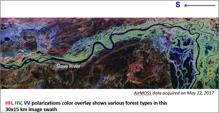
The 117 planned AirMOSS flight lines in Canada and Alaska are shown in the attached maps respectively. So far we have successfully completed 6 of the 8 flights, including sites near Great Slave Lake, Daring Lake, Delta Junction, Southwest Alaska, Yukon Delta, Denali, and Seward Peninsula. Both the radar and the aircraft performed well and the polarimetric quick look images showed some amazing landscape all throughout the northern country. Attached is a polarimetric image of northern Alberta, Canada, showing the different forest types as we traveled southward.

AirMOSS Radar Coverage in Canada

AirMOSS Radar Coverage in Alaska

Quicklook AirMOSS Image of Northern Alberta
