
The Ka-band radar aboard the JSC G-III successfully completed a short deployment to Hawaii where we conducted two local science flights to image the Kilauea volcano lava field. In the mean time, the L-band radar aboard the AFRC C-20A was tasked by FEMA to deploy to the east coast in response to the extensive flooding caused by Hurricane Florence. The aircraft imaged Catawba River (North Carolina) and Pee Dee River (South Carolina) en route to Gainesville, FL on Monday, 17 September. The attached quicklook polarimetric color composite image of Pee Dee River shows extensive inundation along the river (various shades of pink pixels covering the broad area along the river, 8 to 10 km wide).
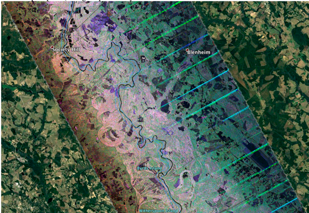
UAVSAR HH/HV/VV (RGB) color composite image displayed in Google Earth.
Image swath is ~ 20 km cross track flown in 150 degrees heading looking left. This
image of Pee Dee River was acquired on 17 September. Extensive inundation
(various shades of pink pixels) along the present day river and old river
bed across a broad area of 8 to 10 km.