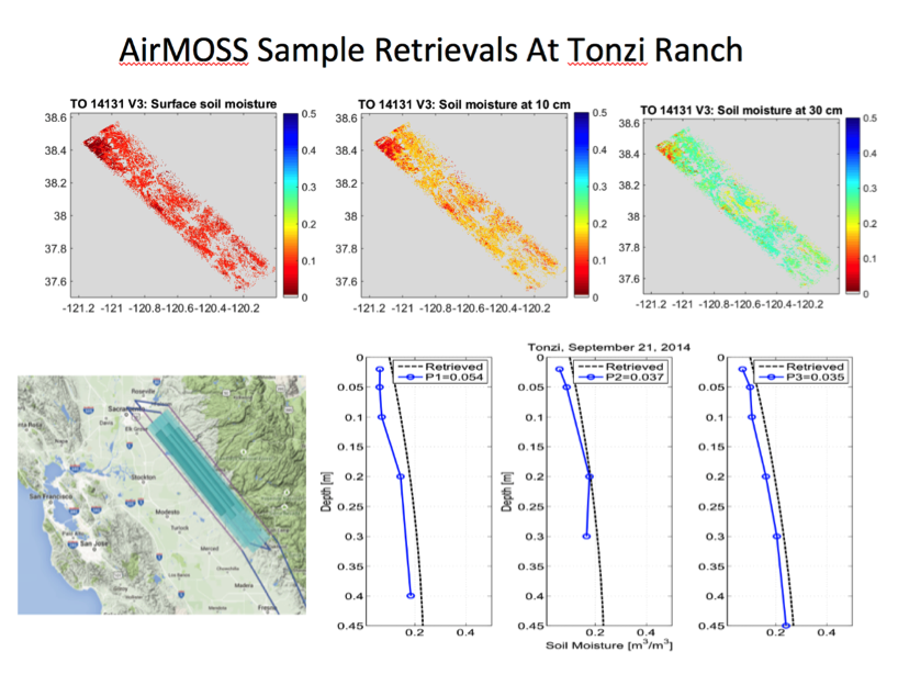
AirMOSS - Airborne Surface Water and Ocean Topography
The P-band Synthetic Aperture Radar aboard the JSC G-III has embarked on the second half of the 2017 ABoVE (Arctic-Boreal Vulnerability Experiment) Airborne Campaign in Canada/Alaska. Data was acquired over AirSWOT flight tracks near Saskatoon and boreal forest over the BERMS site, imaged large transects of boreal forest in eastern Alberta, as well as Fort Resolution, the mouth of Slave River at the southern shore of Great Slave Lake.

