
Aircraft Team: Friday, September 9 marked the first successful CORAL science data collection day for PRISM on board the Tempus Gulfstream IV!
You are here
News
09/16/2016
The Ka-band single-pass interferometer aboard the AFRC C-20A jet is on its Western US glacier survey deployment (PI: Andrew Fountain). So far we have completed observations over glaciers in Sierra Nevada (California) and the Cascades in Oregon and Washington State.
09/16/2016
The ER-2 and the P-3 performed three coordinated science flights on September 10, 12, and 14. Amongst many other instruments were JPL’s AirMSPI onboard the ER-2 and APR-3 on the P-3. Initial qualitative data analysis shows a distinct smoke layer embedded between the low marine stratocumulus cloud layer and mid-level convective cumulus clouds. A few high cirrus clouds were observed as well. One AirMSPI data acquisition was performed above the P-3 observing the solar radiance field above, within, and below the aerosol layer over one of the rare cloud-free Atlantic Ocean areas. Many of the main ORACLES observing goals could therefore be achieved early in the deployment.
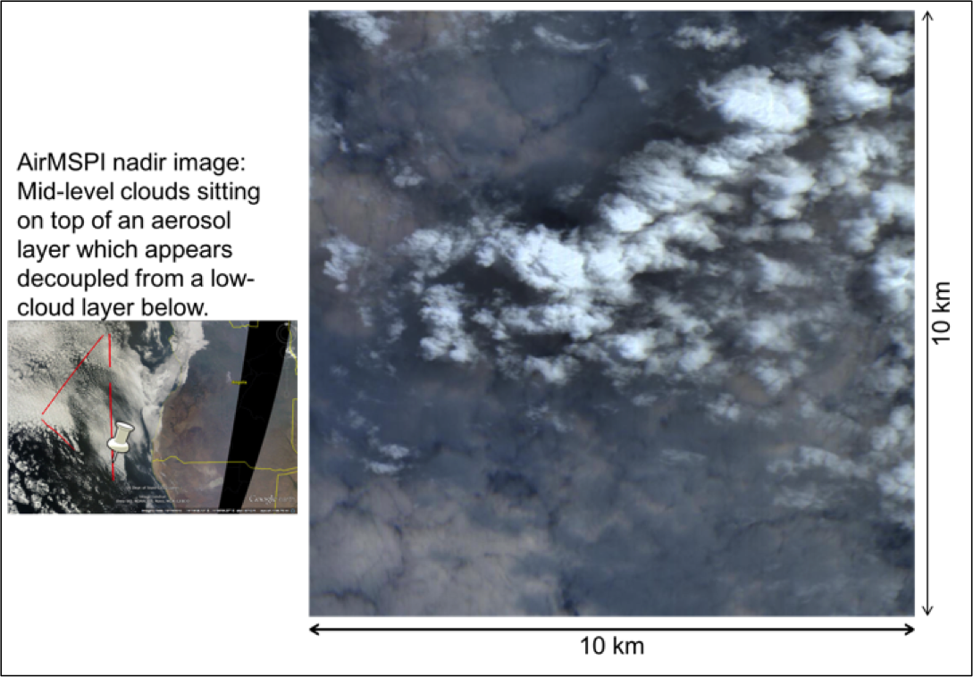
AirMSPI quick look from September 10 of nadir looking data showing an RGB image of the complex atmospheric structure with a smoke layer between low and mid-level cloud layers.
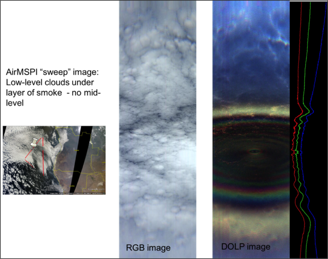
AirMSPI quick look from September 10 showing the full range of viewing angles from 65 degrees forward to 65 degrees backward along the vertical image axis, which represents the flight direction (nadir is in the middle of the image). The DOLP image in the right shows polarization information in three spectral bands. A vertical cut through the center is shown on the far right to illustrate the spectral dependence of the polarization information, which is used in the retrieval of cloud microphysical properties.
08/19/2016
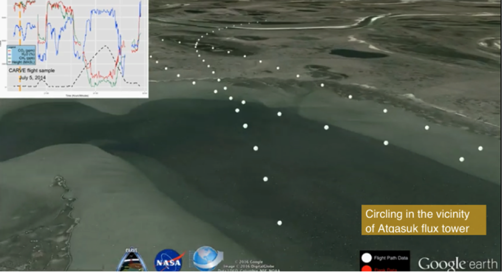
CARVE’s Distributed Active Archive Center (DAAC) produced a "Fly Along with CARVE” video at https://carve.ornl.gov/.
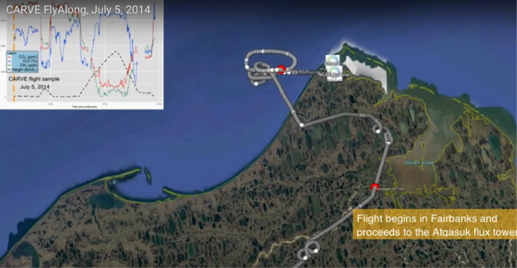
Image of the CARVE Fly Along video (top view)
08/19/2016
All FOUR legs of the SMAPVEX-16 campaign were successfully completed. August 16 was the end of a second two-week campaign undertaken in Iowa. With this flight, the PALS
instrument has flown nearly 27 flights for SMAPVEX-16 – more than any previous SMAPVEX campaign. The campaigns were spread over a period of three months and two Cal/Val sites in Carman, Manitoba and Ames, IA.
Summary of the 2nd Iowan campaign: We flew a total of six site overpass flights over Ames, IA with a calibration maneuver over the Mississippi after every flight. There were no flight-scrubs. There was nearly a week’s gap between the first three flights and last three flights due to overpass schedules and optimal ground conditions.
08/04/2016
AirGravity Science element: With reasonable weather last week, OMG’s AirGravity contractor (Sander or SGL) flew 4 science days last week.
SGL flew for a total of 24.5 flight hours. With Sunday’s flight, SGL completed OMG’s North East Science area.
07/28/2016
Sidharth Misra and his team have successfully completed both Canadian campaigns for SMAPVEX-16. This was the second two-week campaign undertaken in Canada - the first one occurring in the middle of June. The instrument and aircraft both performed well throughout the campaign.
A total of six site overpass flights were flown over Carman, MB, which included a calibration flight over Lake Manitoba.
07/21/2016
AirGravity Science element: With reasonable weather last week, OMG’s AirGravity contractor (Sander or SGL) flew 5 science days last week.
07/21/2016
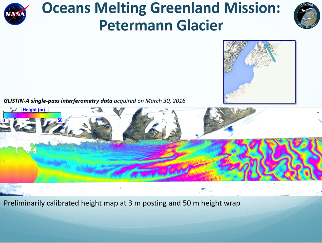
We have completed preliminary processing of all the data takes acquired in Greenland back in March for the Oceans Melting Greenland mission.
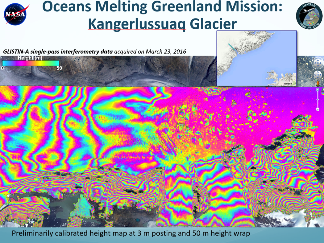
Height map over Kangerlussauq Glacier
06/30/2016
The Classic Airborne Visible and Infrared Imaging Spectrometer (AVIRIS-C) has completed the 2016 HyspIRI Western States Campaign.