You are here

News

03/20/2019

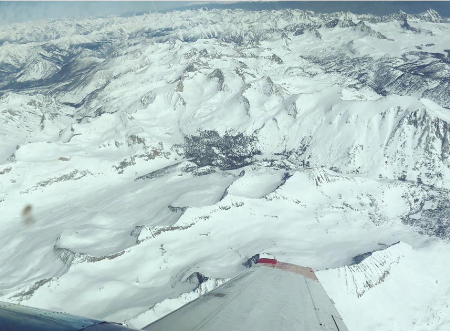
ASO performed snow survey flights over portions of the San Joaquin river basin, Kings River basin, and Kaweah River basin on 15-17 March.  These snow surveys are performed in partnership with the California Department of Water Resources.


ASO flight team surveyed parts of the Kings river basin on Sunday, 17 March

03/14/2019

ASO conducted a successful survey of the Lakes Basin near Mammoth Lakes, CA on 9 March.  This marks the first snow survey of 2019.

02/22/2019

The L-band radar aboard the AFRC G-III conducted its first flight of the 2019 on 19 February.  The AFRC G-III had just returned from a major cockpit upgrade.  Both the aircraft, including the platform precision autopilot, and the radar checked out well.  Thursday we will begin a series of California local science flights.

The Ka-band radar pod will be installed aboard the JSC G-III early next week in preparation for the Oceans Melting Greenland mission’s Greenland deployment.  This will be our fourth annual visit of the coastal Greenland glaciers.

11/29/2018

The L-band radar aboard the AFRC G-III aircraft flew over the Woolsey and Hill fires in Southern California on 15 November as part of the NASA response to the fires.  The flight was at night to stay out of the way of firefighting aircraft in the area.  We also carried a FLIR thermal camera (7.5-13.5 um) supplied by the Mobility and Robotic Systems Section of JPL.   Andrea Donnellan (JPL) has been developing a camera mount system to co-collect optical imagery with SAR data.  We plan to use the thermal camera imagery to attempt to match the active fire front with the SAR imagery.  We flew two existing flight lines that are part of a much larger study understanding regional tectonics (i.e. San Andreas fault) and landslides.  Data from this flight will also serve as a baseline post-fire land surface for studying the landslide and debris flow risks of areas where vegetation was removed by the wildfire.

A JPL press release of the NASA fire response effort can be found here:

https://www.jpl.nasa.gov/news/news.php?release=2018-271


10/11/2018

OMG was featured on HBO’s Vice News Tonight on 3 October, 2018.  A press release was created in advance of the news segment by JPL Public Affairs Office with a video segment, and that is located at: 

https://www.jpl.nasa.gov/news/news.php?feature=7248

10/11/2018

The Next Generation AVIRIS (AVIRIS-NG) has been conducting an airborne survey of methane sources in California.  Last week there was a coordinated flight with the Scientific Aviation Mooney aircraft (Tail Number N2123X) over sites in SF Bay Area.   The Mooney aircraft has in situ methane gas analyzers and performed low level spirals above methane sources, while the King Air flew at 10,000 ft with the AVIRIS-NG to remotely sense the sources areas.

09/27/2018

In all we conducted 5 flights over the Carolinas to map flood extent and inundation change along Neuse, Cape Fear, Lumber, and CatawbaRivers in North Carolina and Pee Dee, Waccamaw, Congaree, and Santee Rivers in South Carolina.

While we were on deployment, we received a request from USFS to image Croatan National Forest near Wilmington, NC to determine flood extent as well as downed trees from reported tornado sightings.  We were able to add a flight line in our last two flights to map the forest.  Polarimetric images of the forest showed extensive flooding, as suspected, and we are working to assist USFS to interpret the images.

Sunday, 23 September’s flight marked UAVSAR’s 1000th flight aboard the AFRC C-20A aircraft since December 2007, a milestone accomplished by the close collaboration of the aircraft team at AFRC and the instrument team at JPL.
09/27/2018

The next generation AVIRIS (AVIRIS-ng) has been flying the CA Methane Airborne Survey on the Dynamic Aviation King Air.  Flights have been conducted in the Southern CA, San Joaquin Valley and the Bay Area.  There have been coordinated flights with the CIRPAS Twin Otter which is flying a Navy Wind Lidar. 

The Classic AVIRIS (AVIRIS-C) has completed the 2018 flights season on the NASA ER2.

09/27/2018

ASO completed flights in Klamath National Forest and Shasta Trinity National Forest last week for a partnership effort with the US Forest Service.

09/20/2018

AVIRIS Next Generation (AVIRIS-NG) began flying a CA Airborne Methane Survey on the Dynamic Aviation King Air.    A PG&E controlled methane release was flown with AVIRIS-NG near Barstow, CA and there was a coordinated flight with CIRPAS Twin Otter that was flying an Airborne Wind Lidar. 

AVIRIS-C has completed the ER-2 missions for 2018.

Pages